
Quick Answer: Driving from Nairobi to Samburu takes about 5.5 to 6.5 hours across a paved 320 to 355-kilometer (200 to 220-mile) stretch along Highway A2. The journey starts in Nairobi, climbs through the central highlands of Karatina and Nanyuki, and drops past Isiolo into the dry northern scrublands to reach Archer’s Gate. Using a custom 4×4 Safari Land Cruiser is highly recommended for handling the rough sand loops inside the reserve.
Written by Angie Muthoni. Reviewed by Gerard Murero.
Leaving Nairobi at 6:00 AM, the cool morning air smells of damp eucalyptus trees and roasting roadside maize. As you clear the city limits, the morning traffic thins out, opening into the wide pineapple fields of Thika. Driving from Nairobi to Samburu is one of the most interesting overland journeys in East Africa. In a single morning, you move from a bustling highland capital, climb past cold mountain forests, and drop into a hot, red-dirt desert. If the road trip is just one piece of a bigger plan, our master Samburu safari guide covers the lodges, fees, and seasons waiting at the other end.
When you book a safari with Samburusafari.com, our team handles vehicle prep, fuel routing, and gate permits long before your trip starts. Our senior manager Angie Muthoni schedules your morning pickup to clear Nairobi’s city exits before peak commuter traffic builds up. On the open road, our professional driver-guides manage the long driving legs so you can relax and watch the scenery change outside your window.
One rule our drivers never break: the northern sand tracks change constantly. A flash flood can redraw the dirt trails past Archer’s Post overnight, and a route that worked last month can drop you into deep silt today. If you are ever unsure of a local sand track, you stop and ask a local herder before driving ahead. Pride costs you two hours of digging; a question costs you nothing.
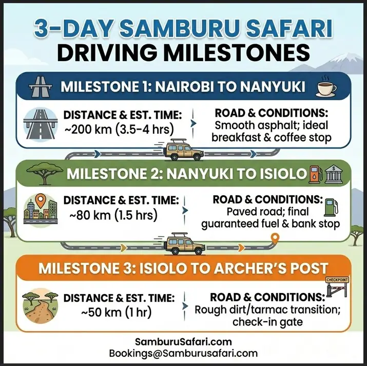
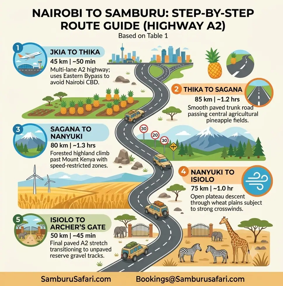
Navigating the 355-kilometer drive from Nairobi to Samburu requires understanding how road conditions and driving times shift across each county. This breakdown details exact segment distances, estimated driving times, and primary terrain characteristics along Highway A2. Use this cheat-sheet to plan your morning departure and anticipate the transition from highland asphalt to northern dirt tracks.
Route Segment | Dist. & Time | Terrain & Highlight |
JKIA → Thika | 45 km (~50 min) | Multi-lane A2 highway; uses Eastern Bypass to avoid Nairobi CBD. |
Thika → Sagana | 85 km (~1.2 hrs) | Smooth paved trunk road passing central agricultural pineapple fields. |
Sagana → Nanyuki | 80 km (~1.3 hrs) | Forested highland climb past Mount Kenya with speed-restricted zones. |
Nanyuki → Isiolo | 75 km (~1.0 hr) | Open plateau descent through wheat plains subject to strong crosswinds. |
Isiolo → Archer’s Gate | 50 km (~45 min) | Final paved A2 stretch transitioning to unpaved reserve gravel tracks. |
If you land early in the morning at Jomo Kenyatta International Airport (JKIA) and want to head straight north, do not drive through central Nairobi. Ask your driver to take the Eastern Bypass through Ruiru. This outer ring road connects you straight to the A2 Thika Superhighway near Kenyatta University, cutting out up to 90 minutes of central city gridlock.
As you cross from Kiambu into Murang’a County, skip the crowded roadside petrol stations in Karatina. Instead, turn off near the Sagana River bridge at Savage Wilderness. This spot offers clean private washrooms, shaded river gardens under indigenous trees, and fresh Arabica coffee brewed on-site.
Past Naro Moru, the highway enters the shaded forest corridor near the Burguret River. Keep your speed under 70 km/h here. Sykes monkeys and black-and-white colobus monkeys frequently leap across the low tarmac tree canopy. Hitting these low-flying primates is a major risk if you drive too fast through the shade.
Nanyuki sits right on the equator at the base of Mount Kenya. If you plan to stock up on fresh fruit, snacks, or ice at Cedar Mall’s Naivas supermarket, aim to arrive before 1:00 PM on weekends. Fresh produce sells out quickly to weekend visitors, leaving only limited options further north in Isiolo.
Once you leave Nanyuki and climb toward the Timau escarpment, the driving conditions change fast:
Before reaching your camp entrance, make sure your digital gate passes are cleared by reading our guide on park entry fees for Samburu National Reserve.
Driving north of Mount Kenya introduces environmental and security factors that generic navigation apps do not flag. From high-altitude wind gusts to unexpected security checks, knowing what lies ahead keeps your trip safe and on schedule. Review these five critical road hazards before taking the wheel on Highway A2.
Route Hazard | Specific Risk | Required Action Step |
Burguret Forest Corridor | Primate roadway crossings (Sykes/Colobus) | Cap driving speed under 70 km/h in shaded tree canopy areas. |
Timau Wheat Plains | Heavy crosswinds destabilizing tall vehicles | Lock 4×4 Safari Land Cruiser pop-up roof latches securely before driving. |
Isiolo Army Checkpoint | Commercial drone checks & inspection delays | Keep drone units and camera bodies stowed inside daypacks out of sight. |
Archer’s Post Fuel Pumps | Contaminated diesel clogging fuel filters | Avoid village pumps; refuel exclusively in Isiolo town prior to arrival. |
Remote Sand Tracks | Signal loss & shifting deep silt tracks | Download offline maps in Nairobi & ask local herders/escorts if unsure. |
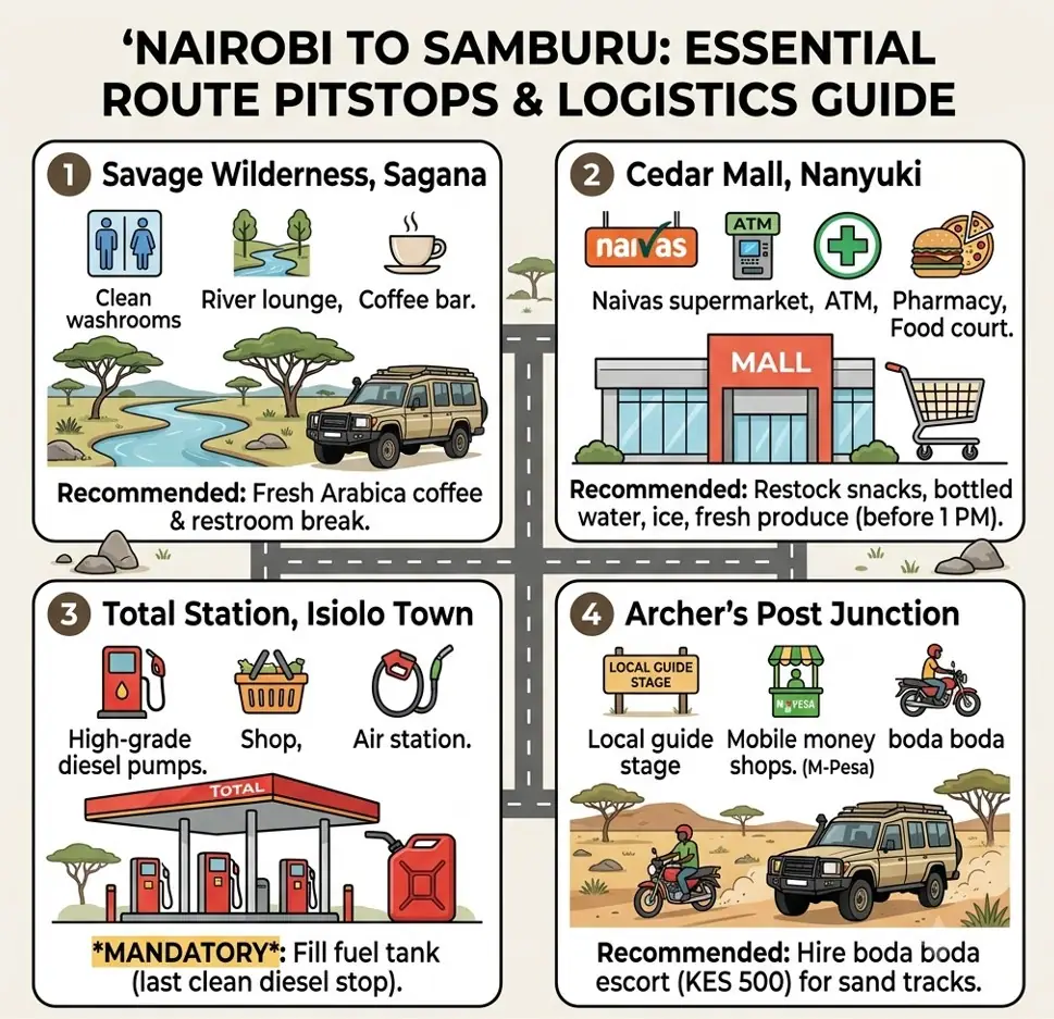
Facilities become sparse once you drop past Nanyuki into the northern scrublands, making planned stopovers essential for a comfortable trip. Stopping at verified locations ensures access to clean restrooms, quality food, and unadulterated fuel. Here is the strategic directory of recommended stops between Nairobi and Samburu National Reserve.
Stopover Location | Key Facilities | Recommended Action |
Savage Wilderness (Sagana) | Clean washrooms, river lounge, coffee bar | Stop for fresh Arabica coffee and a morning restroom break. |
Cedar Mall (Nanyuki) | Naivas supermarket, ATM, pharmacy, food court | Restock snacks, bottled water, ice, and fresh produce before 1:00 PM. |
Total Station (Isiolo Town) | High-grade diesel pumps, shop, air station | Mandatory: Fill fuel tank completely; last clean diesel stop before reserve. |
Archer’s Post Junction | Local guide stage, mobile money shops | Hire a local boda boda escort (KES 500) to navigate unmapped sand tracks. |
Deciding between driving overland or taking flights from Nairobi to Samburu depends on your travel schedule and total budget.
Journey Feature | Overland 4×4 Safari Land Cruiser | Regional Flight from Wilson Airport |
Travel Duration | 5.5 to 6.5 hours | 50 to 75 minutes |
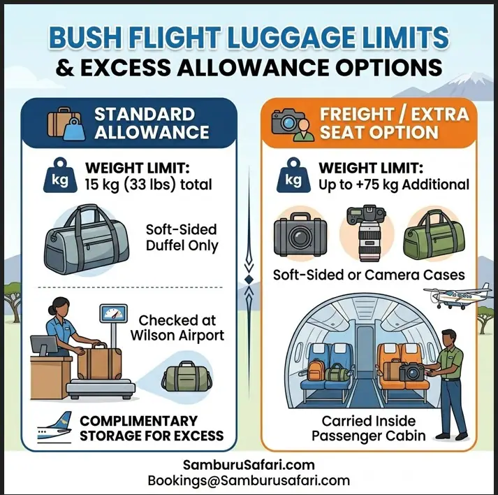
Baggage Restrictions | Flexible (hard and soft bags allowed) | Strict 15kg (33 lbs) limit in soft duffels |
Scenery & Local Stops | High (markets, equator, coffee stops) | Aerial views of Mount Kenya & Laikipia |
Overall Cost Value | Highly cost-effective for 2+ travelers | Higher per-person flight ticket cost |
If you want to save time, flying is a great choice. But if you want to see the central highlands, stop at local markets, and watch the terrain shift gradually, driving gives you a much better feel for the country. To see how each option lands on your total trip bill, our breakdown of the cost of a Samburu safari puts fuel, fares, and gate fees side by side.
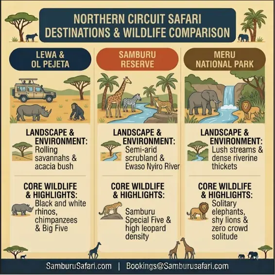
We do not recommend spending more than three nights inside a single public reserve. The best way to see the region is to pair the dry northern river loops with a private sanctuary closer to Mount Kenya.
Our signature overland itineraries loop directly from the northern plains into the neighboring Ol Pejeta Conservancy. This setup lets you track desert-adapted wildlife up north on days one and two, and explore East Africa’s largest black rhino sanctuary on day three.
You can compare full accommodation styles in our guide to luxury lodges in Samburu, or look through our master list of Samburu safari packages to see all options.
The table below outlines our primary multi-destination road packages for 2027 travel dates, based on two people sharing a private 4×4 Safari Land Cruiser.
Package | Trip & Lodges | Price Per Person |
Budget Overland Tier | 4D/3N road trip • Samburu Riverside Camp + Comfort Gardens Ol Pejeta • Full board, private 4×4, daily game drives | $1,480 — 👉 Book Now |
Mid-Range Overland Tier | 4D/3N classic circuit • Samburu Simba Lodge + Sweetwaters Tented Camp • Waterhole views, extended tracking runs | $1,820 — 👉 Book Now |
Luxury Overland Tier | 4D/3N luxury tented stay • Elephant Bedroom Camp + Sanctuary Tambarare • Riverfront cat tracking, evening drives | $2,590 — 👉 Book Now |
Luxury Plus Overland Tier | 4D/3N luxury road & air loop • Sasaab Lodge + Ol Pejeta Bush Camp • Dedicated cruiser & guide, night tracking | $5,280 — 👉 Book Now |
To keep your road journey comfortable, keep a small daypack inside the vehicle cab with these essentials:
Yes, Highway A2 is 100% paved tarmac all the way from Nairobi to Isiolo and Archer’s Post. You only leave the asphalt once you turn off at Archer’s Post onto the unpaved approach roads leading to the reserve gates.
The drive is smooth year-round, but the dry months from July to September and January to February offer clear road conditions and bright mountain views. Check our guide on when to go to Samburu to plan your timing around wildlife movements.
A 2WD saloon car can manage the paved highway to Archer’s Post, but it will struggle on the deep river sand and rocky tracks inside the reserve. We strongly recommend using a high-clearance 4×4 Safari Land Cruiser for safety and comfort. If you plan to skip the driver-guide and take the wheel yourself, our guide to renting a car for Samburu covers vehicle choice and rental pitfalls in detail.
Message us directly for custom itineraries and the latest seasonal offers.